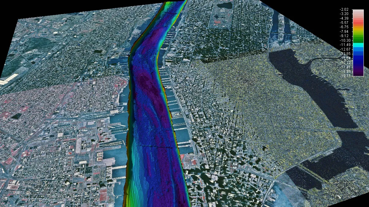
Hudson River Mapping
In 1998, the New York State Department of Environmental Conservation through the Hudson River Estuary Program (HREP) began an extensive Hudson River mapping project in partnership with Lamont-Doherty Earth Observatory and SUNY Stony Brook to visualize the bottom of the river. The project mapped the estuary bottom from Troy all the way down to the Battery collecting information on the depth, bottom features, bottom surface hardness and sediments, and human impacts.
The data has been translated into visualizations to see the bathymetry (depth of the water) of different sections of the Hudson. The river has been divided into different sections so you can compare and contrast different areas with your students. For each site, there is PowerPoint (also offered as a PDF) with background information available in "Notes" view to share with your students. Small movie fly-throughs of the various parts of the river are also available (credit Frank Nitsche, Lamont-Doherty Earth Observatory). For more visualizations on the Hudson River, visit Frank's research page on his website.