Hudson Ups and Downs
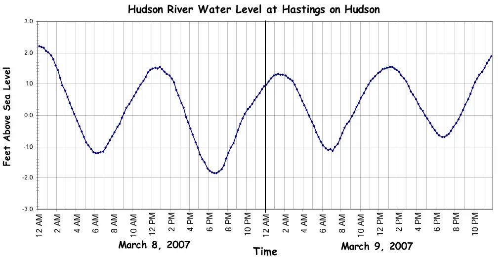
The Hudson River flows 315 miles from the High Peaks of the Adirondack Mountains to New York Harbor. While the river has one name, it can be divided into two distinct sections. The two line graphs below illustrate some of the differences between these sections. They show the water level of the Hudson at Hadley and at Albany. To make these graphs, instruments record the water level every 15 minutes. The water level is not measured from the river bottom; the Hudson is not 567 feet deep at Hadley! Instead, the water’s height is measured in relation to sea level.